Rivers and Waterfalls
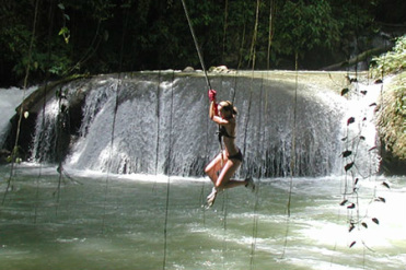
There are over a hundred (100) Rivers in Jamaica.Not all these rivers are explore. There are thirty-two (32) most popular rivers, however, that are names and explored. Most rivers are broken by waterfalls. While some are only used for domestic purposes. We will focus on those explored rivers used for Tourism and is mostly enjoyed by our visitors. There rivers are used for recreational activities such as swimming, rafting, transportation and fishing.
Main Rivers in Jamaica used for Tourism:
|
"Meet me by the River..............Fun Fun Fun"
|
Jamaica, a member of the Greater Antilles, lies 150 kilometers south of Cuba and 160 kilometers west of Haiti. Jamaica is the largest of the West Indian islands. It has an area of 11,424 square kilometers, and is 243 kilometers long. Jamaica is a lush tropical island in the heart of the Caribbean.
The most striking physical feature of Jamaica is its mountainous nature. Nearly half the island is over 300m above sea level. The mountains of the island are located mostly on the interior and can be broken up into three main groups.
The first group situated in the eastern section is composed of the Blue Mountains. They are the highest mountains in Jamaica, reaching 2,250 meters and are about 75 kilometers long. The first group is also composed of the John Crow Mountains and are the most easterly mountains of the island, running form north-west to south-east in the parish of Portland, and divide the Rio Grande valley from the east coast of the island.
The second group or central region, is formed chiefly of limestone, and extends from Stony Hill to the Cockpit country. The central range starts from Stony Hill and runs in a westwards and north-easterly direction through Mammee Hill, Red Hills, Bog Walk, Guy’s Hill, Mount Diablo and finally into the Cockpit country.
The third section is the western section with Dolphin Head as its center. These lush green mountains are home to a rich river network. The rivers of Jamaica generally flow north or south from the interior to the coastline, since the mountains whose slopes they start on run west to east. They are over 120 rivers in Jamaica. The largest of the rivers in Jamaica is the Black River. It is 73 kilometers long. Another popular river of the island is the Rio Grande, which has its course through some of the wildest and most beautiful scenery in the island. For these reasons, rafting on this river has become an extremely popular sporting pastime. The principal rivers of the island are listed below.
|
St. Thomas The Plantain Garden River The Yallahs and Morant Rivers |
Portland The Rio Grande The Swift Buff Bay Spanish Rivers. |
St. Mary The Wag Water The Dry River Rio Nuevo White River. |
St. Ann The Roaring River Llandovery River Rio Bueno |
In Clarendon The Milk River Rio Minho |
